
Pacific Coast Highway: A Journey Along America's Most Scenic Coastline from San Diego to Seattle
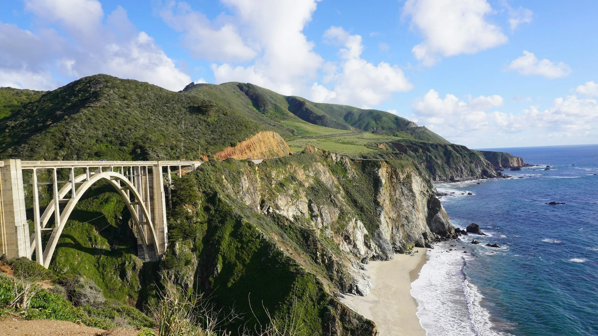
Shot of the Bixby Bridge in Big Sur along the Pacific Coast Highway.
The Pacific Coast Highway tells a story that stretches over 1,200 miles of America's most dramatic coastline, where the vast Pacific Ocean meets towering cliffs, ancient redwood forests, and some of the nation's most vibrant cities. This legendary route weaves together landscapes so diverse they seem drawn from different continents – from Southern California's sun-soaked beaches and desert meeting the sea, to the rugged wilderness of the Pacific Northwest where temperate rainforests cascade down to rocky shores.
More than just a highway, this coastal journey represents the American West at its most spectacular. Highway 1 carves its path along clifftops that drop hundreds of feet to crashing waves below, while the route north through Oregon and Washington reveals a coastline shaped by volcanic forces, glacial rivers, and some of the most pristine wilderness left in the continental United States.
The Southern California Riviera
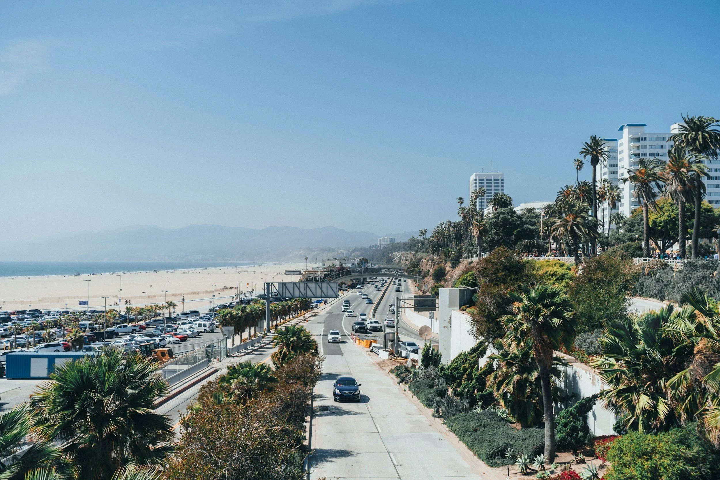
Shot of the view of the California Riviera representing how luxury and life goes right up to the edge of the beach.
The journey begins where America meets the Pacific in its most glamorous form. San Diego's coastline represents the perfect marriage of Mediterranean climate and endless ocean horizons. Here, the Pacific Coast Highway starts not with dramatic cliffs, but with wide sandy beaches where surfers catch waves year-round and beach towns maintain a laid-back rhythm that defines Southern California living.
La Jolla showcases California's upscale coastal personality, where multi-million-dollar homes perch on sandstone cliffs above coves where sea lions bask in the sun. The contrast is immediately apparent – this is a coastline where luxury and wild nature exist side by side. Children's Pool Beach becomes a natural amphitheater where harbor seals gather, seemingly oblivious to the exclusive neighborhood surrounding them.
Moving north, the highway reveals how geography shapes culture. Encinitas and Carlsbad demonstrate how California's coastal communities have grown around the rhythm of waves and weather. Flower farms stretch inland from the coast, taking advantage of the marine layer that keeps temperatures moderate year-round. These aren't just pretty landscapes – they're agricultural systems that exist because of the Pacific's moderating influence on the climate.
Where Mountains Meet the Ocean
North of Los Angeles, the Pacific Coast Highway begins to reveal its true dramatic character. At Malibu, the Santa Monica Mountains plunge directly into the sea, creating the kind of coastal scenery that has made this stretch of road famous worldwide. Here, the highway becomes more than transportation – it becomes theater, with each curve revealing new compositions of mountain, sea, and sky.
Point Dume State Beach demonstrates how geological forces create natural art. The headland rises dramatically from the ocean, its sedimentary layers telling stories of ancient seas and mountain-building events. From its heights, the view stretches across Santa Monica Bay to the Palos Verdes Peninsula, revealing how the Southern California coast is actually a series of mountain ranges that march into the Pacific.
The transition from urban to wild happens gradually, then suddenly. One moment, the highway passes through Malibu's celebrity enclaves; the next, it winds through protected wilderness where mountain lions still roam and condors soar overhead. This juxtaposition – of wild nature and human ambition existing within miles of each other – defines much of the California coastal experience.
The Central Coast: Where California Becomes Sublime
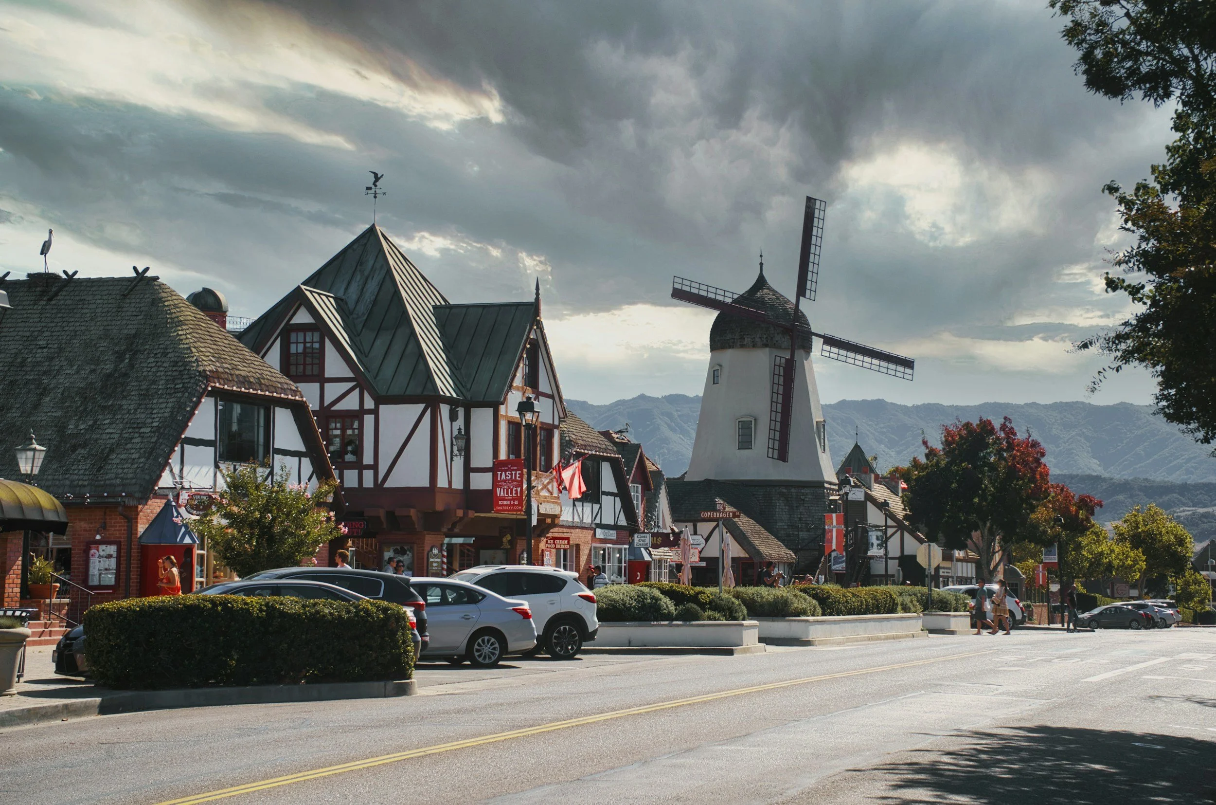
Shot of Solvang, a small dutch town in the heart of the St. Ynez Mountains and just a short detour off of Hwy 1.
Beyond Ventura, the Pacific Coast Highway enters its most celebrated section, where the landscape becomes genuinely sublime. The Santa Ynez Mountains create a dramatic backdrop as the road winds through Goleta and approaches Santa Barbara. Here, the coastline assumes the character that early Spanish explorers found so compelling – a Mediterranean landscape of oak-studded hills meeting a brilliant blue sea.
Santa Barbara represents California coastal living at its most refined. The city's Spanish colonial architecture isn't just decoration; it's a response to climate and culture that makes sense in this setting. Red tile roofs and white stucco walls reflect the intense sunshine while creating cool courtyards and shaded walkways. The harbor hosts working fishing boats alongside recreational yachts, maintaining connections to both the sea's practical and pleasure-giving qualities.
North of Santa Barbara, the highway begins one of America's great scenic drives as it approaches Big Sur. But first, it passes through landscapes that reveal California's agricultural abundance. The Salinas Valley stretches inland like a green carpet, its fertile soil created by millions of years of mountain erosion. This is where much of America's produce grows, in fields that exist because the coastal mountains trap moisture from Pacific storms.
Big Sur: Where America Meets the Infinite
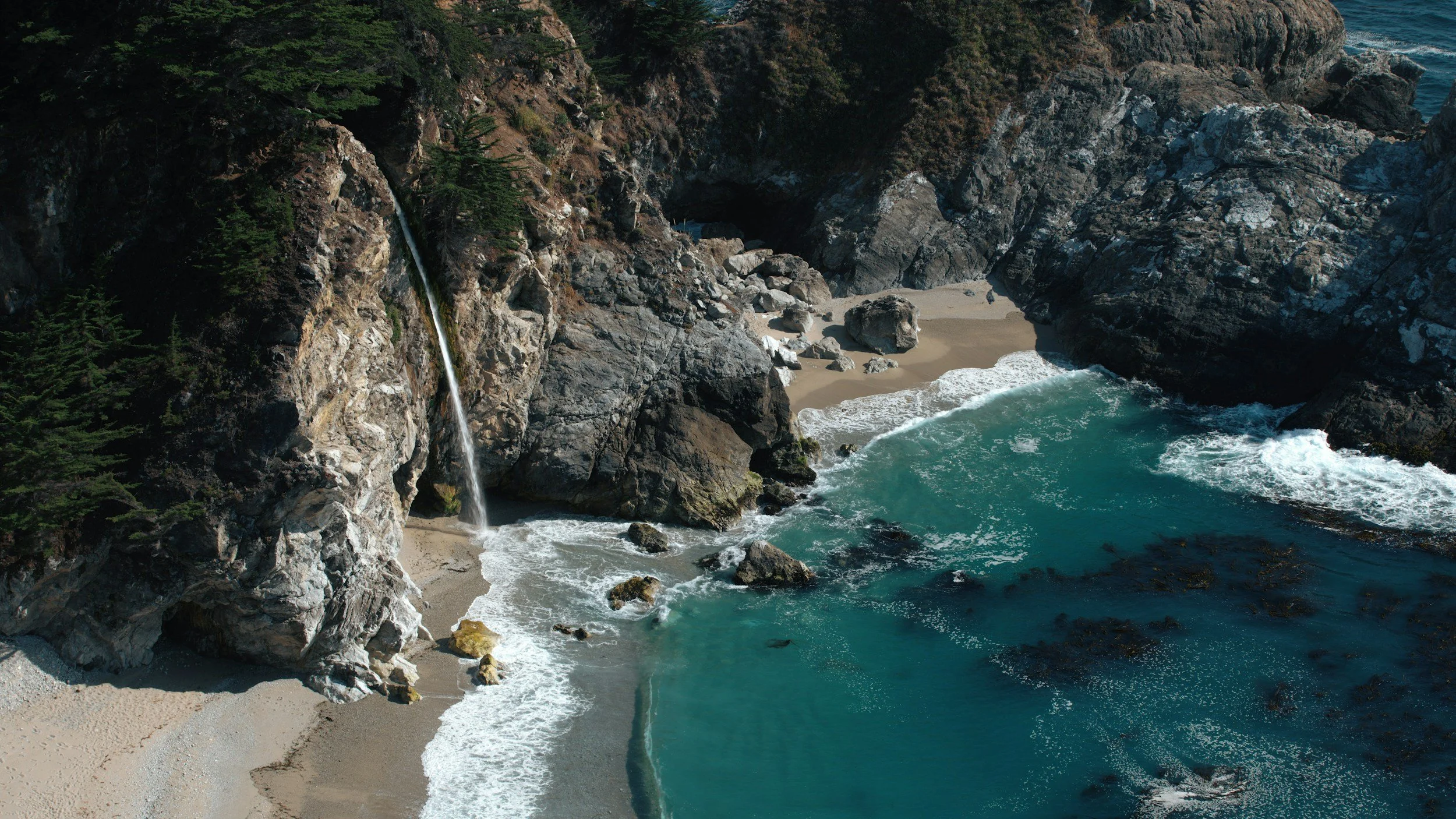
Shot of McWay Falls on a sunny day.
Big Sur represents the Pacific Coast Highway at its most mythical. Here, the Santa Lucia Mountains rise directly from the Pacific, creating a coastline so dramatic it seems almost fictional. The highway, carved into cliffsides hundreds of feet above the waves, becomes a narrow ribbon connecting small communities that seem to exist outside normal time and space.
The landscape here operates on geological timescales that humble human perspective. McWay Falls drops 80 feet directly onto the beach below, its fresh water joining the Pacific in a scene that has remained essentially unchanged for millennia. The waterfall exists because underground streams, fed by coastal fog and winter rains, find their way through fractured granite to emerge at the cliff's edge.
Bixby Creek Bridge, completed in 1932, represents human engineering responding to natural grandeur. The concrete arch spans 700 feet across a canyon that drops to the Pacific below, its Art Deco lines somehow enhancing rather than competing with the natural landscape. Standing on the bridge, visitors experience vertigo not just from the height, but from the sense of standing at the edge of a continent.
The redwood groves that appear in Big Sur's canyons create cathedral-like spaces where fog-filtered light creates an almost mystical atmosphere. These trees, some over 1,000 years old, grow here because the Pacific creates the perfect conditions – cool, moist air that condenses into fog during summer months, providing water during the dry season. They're living monuments to the ocean's influence on terrestrial life.
Monterey Bay: Where Natural History Lives
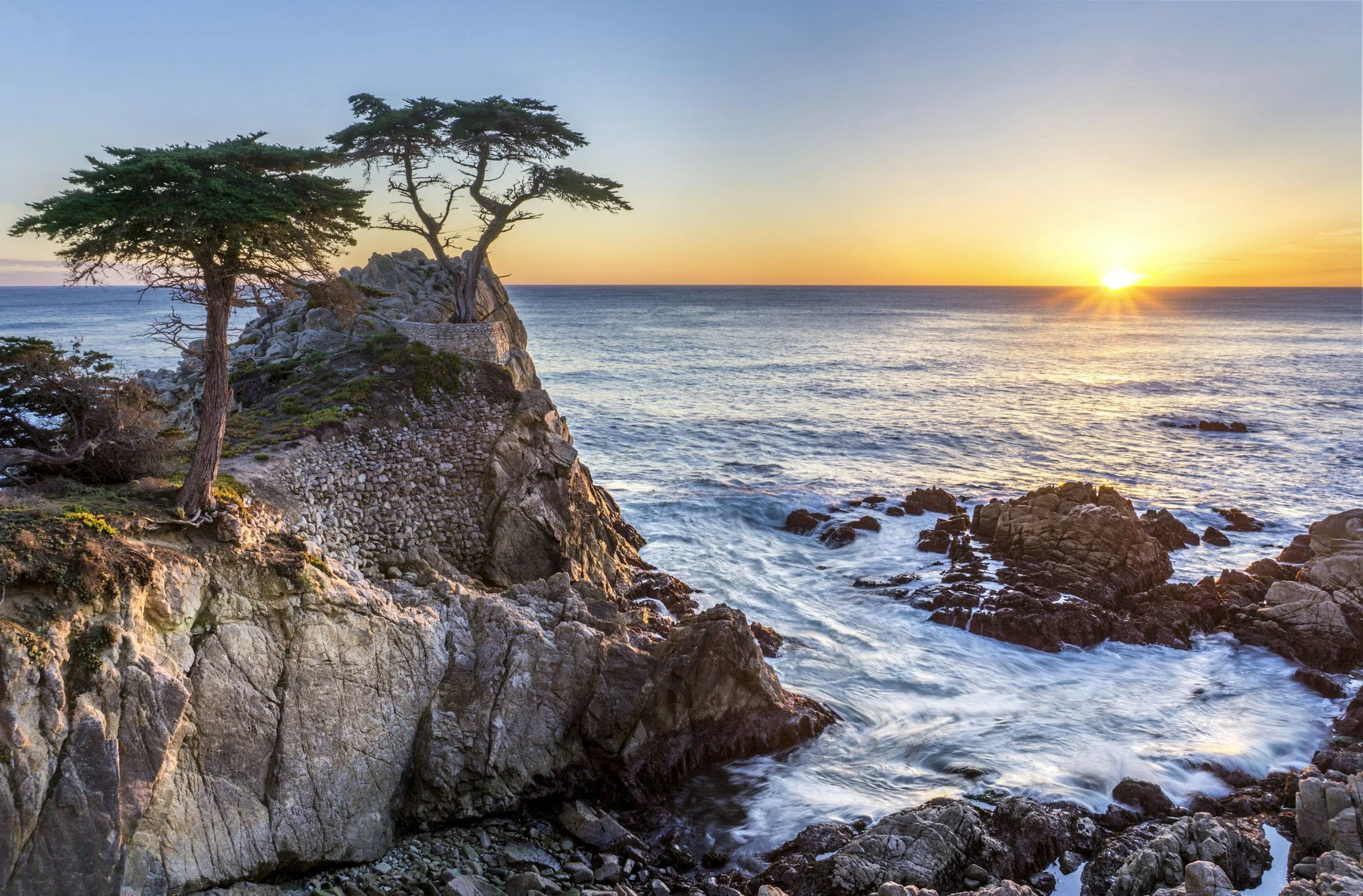
Shot of the sunset over the coast at Carmel-by-the-Sea.
The approach to Monterey reveals how the Pacific Coast Highway connects not just places, but ecosystems. Monterey Bay, with its submarine canyon that drops to depths greater than the Grand Canyon, creates upwelling currents that bring nutrients from the deep ocean to the surface. This phenomenon supports one of the world's most diverse marine ecosystems, from microscopic plankton to blue whales.
Carmel-by-the-Sea presents California coastal living as fairy tale, with storybook cottages nestled among Monterey pines and cypress trees sculpted by constant ocean winds. The town's architecture reflects its artistic heritage, but it's also a response to the coastal environment – small windows to conserve heat, steep roofs to shed rain, and courtyards protected from ocean breezes.
Point Lobos State Natural Reserve showcases the central coast's wild character. Here, sea otters float in kelp forests just offshore while harbor seals haul out onto rocky beaches. The reserve's twisted cypress trees, shaped by salt spray and constant wind, create natural sculptures that seem to capture the essence of life adapting to coastal forces.
San Francisco: Where Coast Becomes Culture
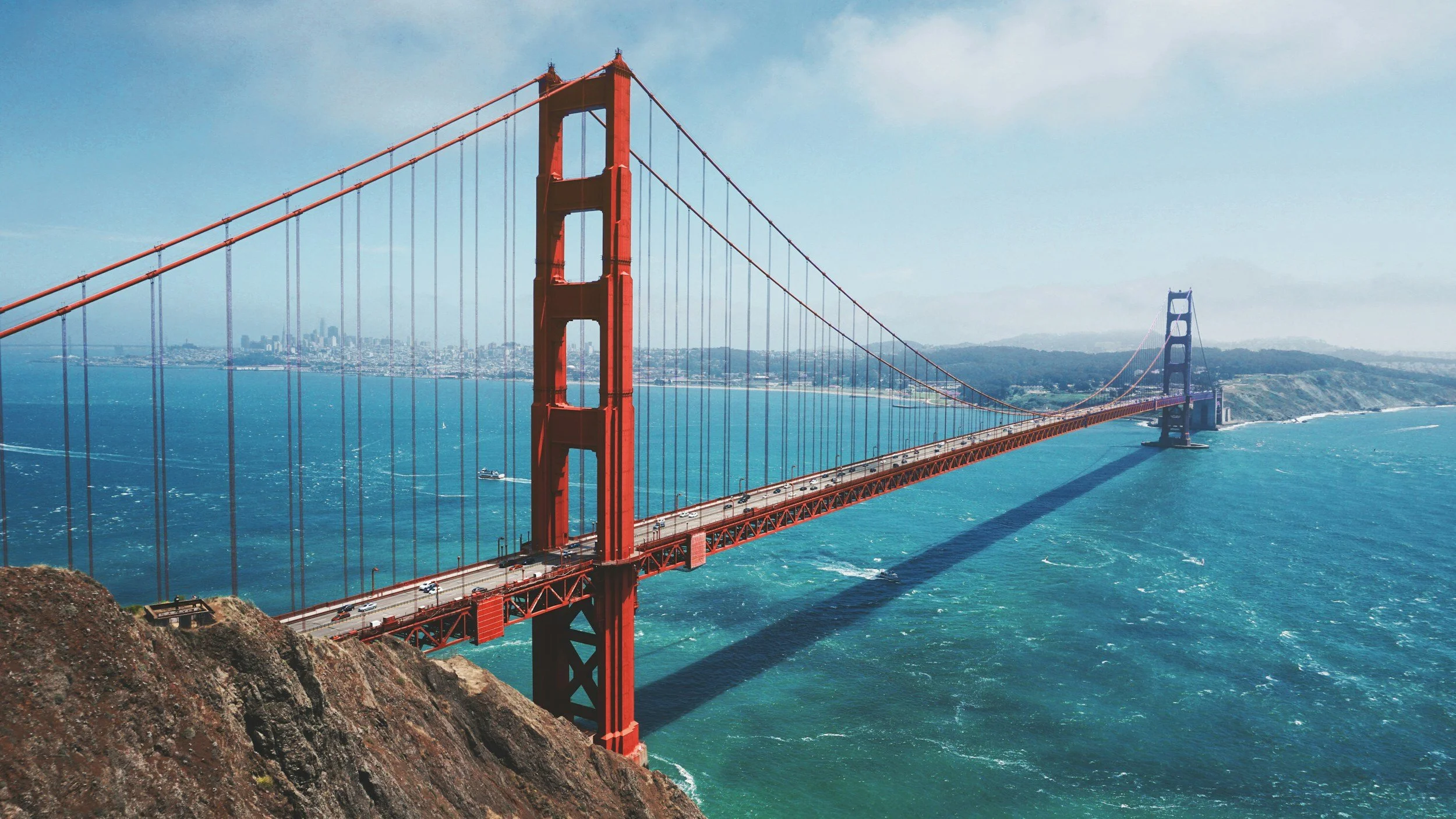
Shot of the famous Golden Gate Bridge.
The approach to San Francisco reveals how geography creates destiny. The Golden Gate, the narrow opening where San Francisco Bay meets the Pacific, has determined the city's character since its founding. The constant flow of marine air through this gap creates San Francisco's famous fog and moderate temperatures, but it also made the city a natural harbor and gateway to California's interior.
The Golden Gate Bridge represents human engineering at its most sublime, not just because of its Art Deco beauty, but because it works so perfectly with its setting. The International Orange paint was chosen not just for visibility in fog, but because it harmonizes with the surrounding landscape of golden hills and blue water. The bridge doesn't conquer the landscape; it completes it.
San Francisco's neighborhoods reflect their relationship to the ocean. The Richmond and Sunset districts, facing the Pacific directly, maintain a quieter, more residential character shaped by fog and ocean breezes. Pacific Heights earns its name from elevation that provides views over the bay while catching more sunshine. Even the city's famous Victorian architecture responds to the coastal climate – bay windows to capture light, steep roofs for rain runoff, and colorful paint schemes that show up in frequent fog.
Northern California: Where Wilderness Reclaims the Coast
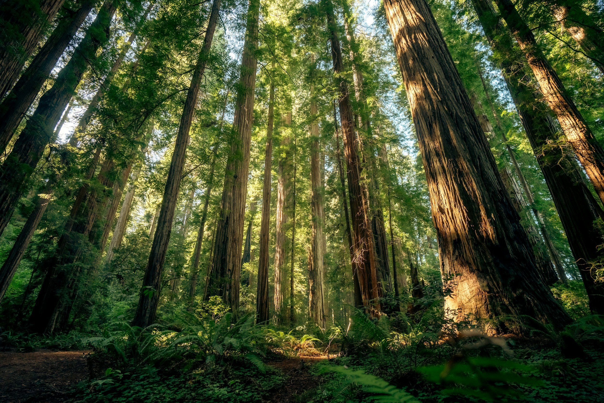
Shot of the Great Redwood Forest
North of San Francisco, the Pacific Coast Highway enters a different world as it approaches the redwood country. Here, the highway becomes Highway 101, but the coastal experience intensifies rather than diminishes. The Sonoma and Mendocino coasts reveal California before extensive development, where small towns exist in harmony with landscapes that remain fundamentally wild.
Mendocino, perched on bluffs above the Pacific, captures the essence of Northern California's coastal character. The town's Victorian architecture reflects its logging heritage, when redwood forests seemed inexhaustible and small coastal communities could thrive on harvesting the giant trees. Today, the preserved buildings serve as reminders of how quickly resource extraction can transform into heritage tourism.
The redwood forests that begin in earnest north of San Francisco represent ecosystems unlike anywhere else on Earth. These trees, the tallest living things on the planet, exist because of the Pacific's influence – the fog that condenses on their needles provides up to 40% of their water needs during dry summers. Walking among them creates an almost cathedral-like sense of reverence, not just for their age and size, but for their dependence on oceanic processes.
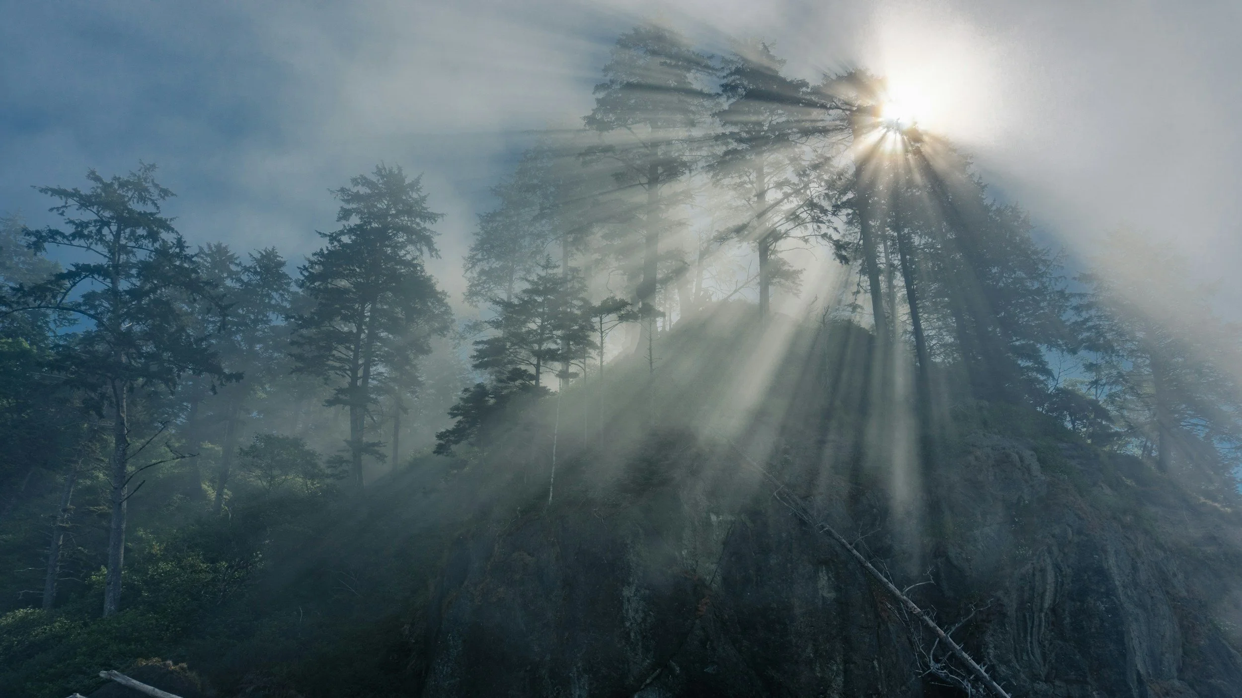
Oregon: Where the Coast Becomes Primal
Shot of the dramatic landscape of the Oregon coastline.
The transition from California to Oregon marks a shift from Mediterranean to maritime climate, and the coastline reflects this change dramatically. Oregon's coast, shaped by different geological forces than California's, presents a landscape of headlands, sea stacks, and beaches that seem designed for contemplation rather than recreation.
The Oregon Dunes near Florence represent a unique coastal ecosystem where sand, sculpted by wind and ocean currents, creates an environment that resembles the Sahara more than the Pacific Northwest. These dunes, some reaching 500 feet in height, demonstrate how coastal processes can create landscapes that seem to belong on different continents.
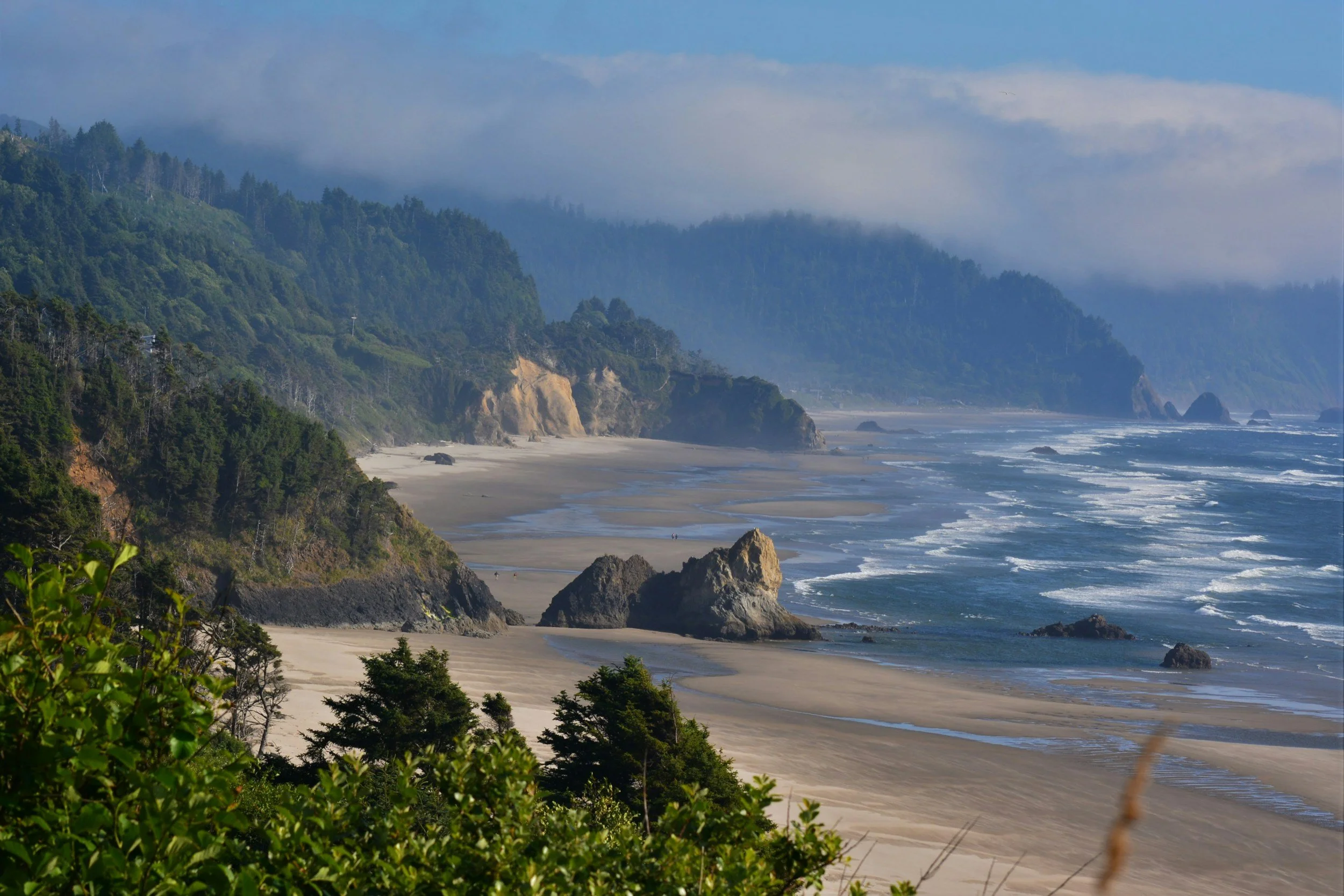
Cannon Beach showcases Oregon's coastal drama at its most iconic. Haystack Rock, a 235-foot monolith rising from the beach, serves as both landmark and ecosystem. During low tide, its base reveals tide pools teeming with sea anemones, starfish, and hermit crabs – entire worlds that exist in the narrow zone between high and low tide.
The coastal headlands of Oregon tell geological stories spanning many years. These formations, many of them ancient seafloor that has been uplifted and tilted, reveal how the Pacific Northwest coast has been shaped by the collision of oceanic and continental plates. At places like Cape Perpetua, visitors can see layers of rock that were once deep ocean floor, now elevated 800 feet above the waves.
Washington: Where Forest Meets the Sea
Shot of the sun peaking through the fog at Ruby Beach.
Washington's coastal section represents the Pacific Coast Highway at its most wild and remote. Here, the Olympic Peninsula's temperate rainforests come down almost to the water's edge, creating a landscape that seems more British Columbia than continental United States. The influence of the Pacific reaches deep inland, creating ecosystems that depend entirely on maritime weather patterns.
The Hoh Rainforest demonstrates how ocean currents can create terrestrial ecosystems. The warm Japanese Current brings moisture-laden air to the Olympic Peninsula, where it meets the Olympic Mountains and drops enormous amounts of rain – up to 140 inches annually in some areas. This precipitation supports temperate rainforests where Sitka spruce and western hemlock grow to enormous sizes, draped in mosses and ferns that create an almost tropical appearance.
Ruby Beach and the other wilderness beaches of Olympic National Park showcase the Pacific Northwest coast in its most primal form. Here, giant logs washed down from mountain forests create natural sculptures on beaches of sand and stone. Sea stacks rise from the surf like ancient cathedrals, while tide pools reveal ecosystems that have remained essentially unchanged for millions of years.
The Puget Sound Finale
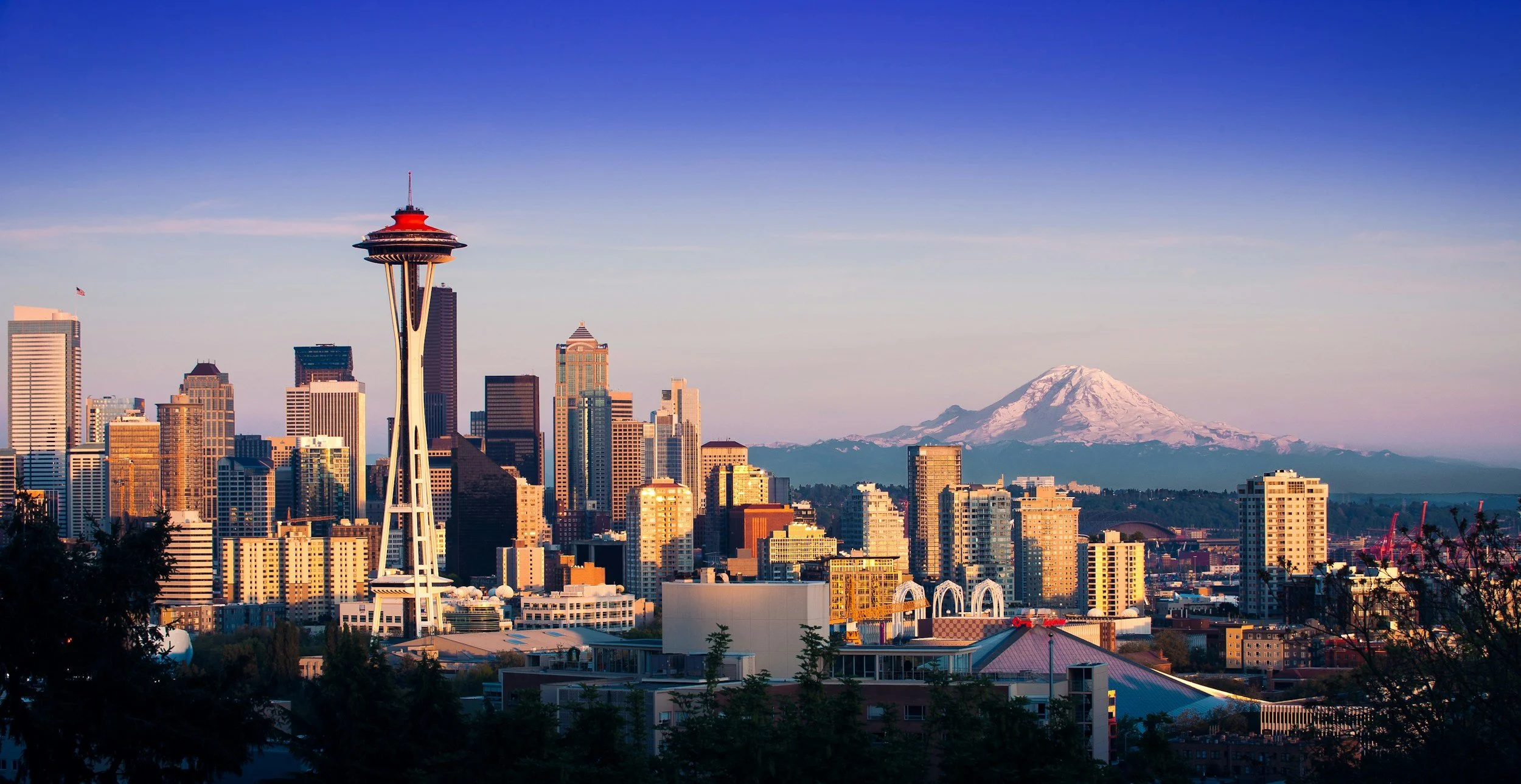
Shot of Seattle Skyline.
The approach to Seattle represents the culmination of the coastal journey as the route transitions from wild coastline to one of America's most dynamic urban areas. Puget Sound, carved by glaciers during the last ice age, creates a complex waterway where saltwater penetrates deep into the continent, bringing marine influences to communities hundreds of miles from the open ocean.
Seattle's relationship with water defines its character as much as its coffee or technology industries. Elliott Bay, where the city meets Puget Sound, provides not just a harbor but a constant reminder of the region's maritime identity. The ferries that cross the sound aren't just transportation; they're part of daily life that keeps residents connected to the water.
The Olympic Mountains, visible across Puget Sound on clear days, serve as a constant reminder of the forces that shaped this landscape. These peaks, still carrying glaciers that feed the rivers flowing into the sound, represent the ongoing geological processes that continue to shape the Pacific Northwest. Even in urban Seattle, residents live within sight of wilderness that exists because of the Pacific's influence on climate and weather.
The Pacific's Endless Influence
Traveling the Pacific Coast Highway from San Diego to Seattle reveals more than spectacular scenery – it demonstrates how a single ocean shapes everything from climate and ecology to human culture and architecture. The Pacific doesn't just provide a scenic backdrop; it creates the conditions that make life possible along the coast.
The marine layer that brings fog to San Francisco also moderates temperatures in Central Valley agriculture. The upwelling currents that support Monterey Bay's marine life also influence weather patterns hundreds of miles inland. The ocean currents that bring moisture to Olympic Peninsula rainforests also determine salmon runs that have shaped Native American cultures for thousands of years.
Each section of this coastal journey tells part of a larger story about how oceanic processes influence terrestrial life. From the desert meeting the sea in Southern California to temperate rainforests in the Pacific Northwest, the highway reveals landscapes that exist because of their relationship to the Pacific.
Planning Your Pacific Coast Journey
The Pacific Coast Highway from San Diego to Seattle requires more than just a car and good weather – it demands an understanding of seasonal patterns, road conditions, and the rhythms of coastal life. Summer offers the most reliable weather and clearest views, but it also brings crowds to popular destinations and higher accommodation prices.
Spring reveals the coast in its most vibrant form, with wildflowers blooming on coastal bluffs and migrating whales visible from headlands. Fall provides some of the year's most dramatic weather, with storm systems creating spectacular wave action and clearing skies that offer exceptional visibility.
Winter travel along the coast requires preparation for rain and occasional snow in northern sections, but it also offers opportunities to experience the coast in its most elemental form. Storm watching becomes a legitimate activity, and the reduced crowds allow for more intimate experiences with coastal landscapes.
The journey typically requires 10-14 days to complete properly, allowing time to explore side roads, hike coastal trails, and experience the distinctive character of different coastal regions. Accommodation ranges from luxury resorts overlooking the Pacific to simple motels that cater to road-trippers, with camping available in state and national parks along the route.
More Than a Road Trip
The Pacific Coast Highway ultimately offers more than transportation between destinations – it provides perspective on how natural forces shape both landscapes and human communities. This is a route where geology becomes visible, where ocean currents influence everything from fog patterns to forest types, and where small coastal communities maintain connections to maritime traditions that stretch back thousands of years.
Every mile reveals new relationships between land and sea, from the sea cliffs of Big Sur to the tide pools of Olympic National Park. The highway doesn't just follow the coast; it reveals how the Pacific Ocean creates the conditions that make the American West unique. Here, travelers don't just observe spectacular scenery; they experience firsthand how oceanic processes influence everything from climate to culture.
The Pacific Coast Highway from San Diego to Seattle represents one of the world's great scenic drives, but more than that, it offers insights into how water, land, and human communities interact to create some of the most beautiful and diverse landscapes on Earth. This is a journey that changes perspective, revealing the Pacific not just as an ocean, but as the force that makes life along America's western edge both possible and extraordinary.
Ready to explore America's most spectacular coastal highway? Our travel specialists can help you plan the perfect Pacific Coast journey, from choosing the ideal season to finding hidden gems and scenic stops that will make your road trip unforgettable.